Keeping Track of Land in Texas
Keeping Track of Land Grants
In Texas, the land granted to individuals for their personal use or to empresarios (developers such as Stephen F. Austin) by Spain, Mexico, the Republic of Texas or the State of Texas eventually was recorded and mapped by the Texas General Land Office (GLO). Consequently, if a tract of land can be traced back to an original land grant in a certain county, the location of that land probably can be determined from a GLO map. That is the technique used to locate several of the tracts of land bought and sold by Thomas Haynes.
The amount of land typically granted to an individual varied over time. Larger grants predominated during earlier times. During the time that Stephen F. Austin was settling his colonies, a typical grant to an individual or family was on the order of “a league and a labor.” A (square) league of land is approximately 4,428 acres, and a labor is 1/25th of a league, or approximately 177 acres. The idea behind the “league and a labor” concept was to provide a labor of land along a river or creek, suitable for providing timber, firewood, and crop land, plus an adjoining league of pasture land.
The measurement system used by Stephen F. Austin was that of Spain and Mexico. Distances were measured in “varas”, and the Texas version of “varas” was equivalent to 33-1/3 inches, or 0.9259 yard. Inversely, a yard is approximately 1.08 varas. A labor is one million square varas, so a league must be 25 million square varas. Over time, of course, the units of measurement were gradually shifted to the English system, but some surveys, maps, and deeds contained a mixture of the two.
Keeping Tract of the Land within a Land Grant
Once a land grant was made, the individual county containing the land was responsible for recording any sale or subdivision of the land and keeping track of ownership. Unfortunately, no official mapping or platting was required by the State, and some counties did not begin to require surveys and plats until after 1900. Between 1845 and 1900, then, many deeds described the land being sold only by metes and bounds; that is, in terms of its relationships to various geological features, such as rivers and creeks, or to the distance and direction to various physical objects, such as large trees, or to the fact that the land was next to someone else’s land. Thomas Haynes seems to have been particularly adept at describing a piece of land strictly in terms of objects that could be found there in 1850, such as trees or houses, but that are of little to no use now to someone trying to locate the land on a map.
In more modern terms, once a fairly precise location of a piece of land is known, the land can be found using Google Maps, typically using the Satellite option to get an aerial view of the land and its surroundings. The Google plug-in for computing lengths and areas can then be used to more precisely locate the land in the satellite view, and to determine latitude and longitude of points within the area.
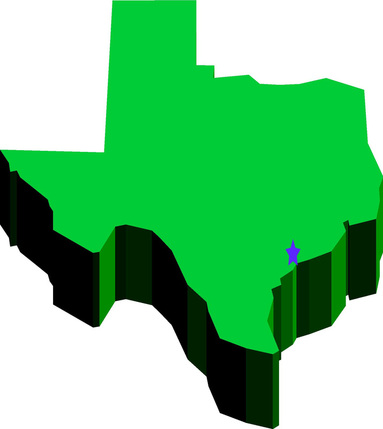
As in several other states, some county lines in Texas have shifted over the years. Until about 1900, most maps of Jackson County treated the land west of the Lavaca River (including “the Haynes place”) as being part of Victoria County. Eventually, the Jackson County line was moved westward to Arenosa Creek and Garcitas Creek. Likewise, some land that was originally considered to be part of Jackson County at its northern end was eventually made a part of Lavaca County (including the first land Thomas Haynes bought in Jackson County). In some (perhaps all) cases, deeds recorded in one county for land that later became part of a different county were copied and entered into the deed books of the new county.
Each county identified its deed books by the letters “A”, “B” … “Z”, and then “1”, “2” …, (and perhaps other numbering schemes) so that the letter or number on a book is an indicator of the relative “age” of the deeds in that book. But in Jackson County, the early deeds that had originally been entered into the Victoria County deed books and later copied into the Jackson County deed books did not get entered into the Jackson County deed books until Jackson County had already filled books “A” through “J”. Therefore, book “K” in Jackson County is special and parts of it are out of order chronologically with the other deed books. Book 1 also contains some early deeds. Independently of this, it is helpful to remember that a person does not have to have a deed recorded immediately, so the order of the deeds in a given book does not necessarily reflect the order in which the transactions occurred. Instead, we must look for the date within the deed itself.
In Texas, the land granted to individuals for their personal use or to empresarios (developers such as Stephen F. Austin) by Spain, Mexico, the Republic of Texas or the State of Texas eventually was recorded and mapped by the Texas General Land Office (GLO). Consequently, if a tract of land can be traced back to an original land grant in a certain county, the location of that land probably can be determined from a GLO map. That is the technique used to locate several of the tracts of land bought and sold by Thomas Haynes.
The amount of land typically granted to an individual varied over time. Larger grants predominated during earlier times. During the time that Stephen F. Austin was settling his colonies, a typical grant to an individual or family was on the order of “a league and a labor.” A (square) league of land is approximately 4,428 acres, and a labor is 1/25th of a league, or approximately 177 acres. The idea behind the “league and a labor” concept was to provide a labor of land along a river or creek, suitable for providing timber, firewood, and crop land, plus an adjoining league of pasture land.
The measurement system used by Stephen F. Austin was that of Spain and Mexico. Distances were measured in “varas”, and the Texas version of “varas” was equivalent to 33-1/3 inches, or 0.9259 yard. Inversely, a yard is approximately 1.08 varas. A labor is one million square varas, so a league must be 25 million square varas. Over time, of course, the units of measurement were gradually shifted to the English system, but some surveys, maps, and deeds contained a mixture of the two.
Keeping Tract of the Land within a Land Grant
Once a land grant was made, the individual county containing the land was responsible for recording any sale or subdivision of the land and keeping track of ownership. Unfortunately, no official mapping or platting was required by the State, and some counties did not begin to require surveys and plats until after 1900. Between 1845 and 1900, then, many deeds described the land being sold only by metes and bounds; that is, in terms of its relationships to various geological features, such as rivers and creeks, or to the distance and direction to various physical objects, such as large trees, or to the fact that the land was next to someone else’s land. Thomas Haynes seems to have been particularly adept at describing a piece of land strictly in terms of objects that could be found there in 1850, such as trees or houses, but that are of little to no use now to someone trying to locate the land on a map.
In more modern terms, once a fairly precise location of a piece of land is known, the land can be found using Google Maps, typically using the Satellite option to get an aerial view of the land and its surroundings. The Google plug-in for computing lengths and areas can then be used to more precisely locate the land in the satellite view, and to determine latitude and longitude of points within the area.
As in several other states, some county lines in Texas have shifted over the years. Until about 1900, most maps of Jackson County treated the land west of the Lavaca River (including “the Haynes place”) as being part of Victoria County. Eventually, the Jackson County line was moved westward to Arenosa Creek and Garcitas Creek. Likewise, some land that was originally considered to be part of Jackson County at its northern end was eventually made a part of Lavaca County (including the first land Thomas Haynes bought in Jackson County). In some (perhaps all) cases, deeds recorded in one county for land that later became part of a different county were copied and entered into the deed books of the new county.
Each county identified its deed books by the letters “A”, “B” … “Z”, and then “1”, “2” …, (and perhaps other numbering schemes) so that the letter or number on a book is an indicator of the relative “age” of the deeds in that book. But in Jackson County, the early deeds that had originally been entered into the Victoria County deed books and later copied into the Jackson County deed books did not get entered into the Jackson County deed books until Jackson County had already filled books “A” through “J”. Therefore, book “K” in Jackson County is special and parts of it are out of order chronologically with the other deed books. Book 1 also contains some early deeds. Independently of this, it is helpful to remember that a person does not have to have a deed recorded immediately, so the order of the deeds in a given book does not necessarily reflect the order in which the transactions occurred. Instead, we must look for the date within the deed itself.